134pp, b&w and colour photos, drawings, maps, distribution maps. The first study to cover the bryophytes of the area of Watsonian vice-county 42, Brecknock (now mostly Powys). The study describes what is known of the distribution of Brecknock’s 388 mosses, 151 liverworts and 1 hornwort.
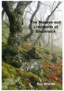
Introduction, followed by the species accounts with distribution maps; interspersed with drawings, and enticing photos of habitats. A4 paperback .
ISBN 0954765915
Graham Motley provided an update in 2014 which can be downloaded below.
Update July 2021
Ray has a number of copies which he is willing to let people have for the price of the postage. If you would like to take advantage of this offer, please email him at raygwoods@aol.com
Introduction
The following overview of the vice-county has been extracted from Ray’s book, and is included here with his kind permission.
Map 1 - Vice-county boundaries
Brecknock, covering 726 square miles, is the fourth largest vice-county in Wales. It is 56 miles north to south and 37 miles east to west. To the west it marches with Cardiganshire and Carmarthenshire, to the south with Glamorgan and to the east and north with Monmouthshire , Herefordshire and Radnorshire vice-counties. It entirely lacks a coastline and is one of the most upland vice-counties of Wales. More than half of it lies above 305 m (1000 ft). It ranges in altitude from 60m (200 ft) in the lowest part of the Usk Valley to 886m (2906 ft) on Pen y Fan in the Brecon Beacons.
Topography
Map 2 – Topography
Hill Blocks
Four major hill blocks can be recognized. In the north lies a wonderfully remote portion of Elenydd. Abergwesyn Common and the Elan Estate make up a significant part of this mostly acidic shale block. It is characterized by sweeping undeveloped and unspoilt moorland plateaux, rising to 641m (2115ft) on Drygarn Fawr, with blocks of conifer plantations along its southwestern edge. Blanket bogs cover the more level ground. Due to the widespread dominance of purple moorgrass, bogmoss-rich areas are very limited in extent. A scattering of mostly low cliffs occurs in the valleys of the rivers Tywi, Irfon, Claerwen and Elan, the major rivers draining this area.
Completely bisecting the centre of the vice-county, the River Usk, rising high on Mynydd Du initially forms the boundary with Carmarthenshire. Impounded by the Usk Reservoir it is released to drain the largest part of central Brecknock forming a wide fertile valley flowing in a generally south eastern direction. It leaves Brecknock near Abergavenny on its way to the Bristol Channel at Newport.
Between the Usk and Irfon lies Mynydd Epynt. This little-explored red sandstone upland was largely taken over by the Ministry of Defence as an artillery range in 1940 and now forms a multi-purpose military training area. It rises to 474m ( 556ft) on Drum Ddu with a number of other summits on this plateau-like area approaching this height. Outcrops are limited in extent but occur in all the short, steep valleys of its distinctive north-west facing escarpments. Its southern slopes dip more gently in a series of spurs to the Usk Valley.
South of the Usk lies the most dramatic bulk of an almost unbroken string of uplands with steep slopes and cliffs on its northern scarp and long gently dipping spurs to the south. At the western end Bannau Brecheiniog at 802m (2632 ft) merges with the Carmarthen Fan to form the Black Mountain (Mynydd Du). Fforest Fawr with a number of summits such as Fan Gyhirych 725m (2381ft ), Fan Nedd 663m (2177ft) and Fan Fawr 734m (2400ft), link the Black Mountain to the Old Red Sandstone peaks of the Brecon Beacons. Pen y Fan is the highest point at 886m (2906ft). To the east lie the Carboniferous Limestone and Millstone Grit uplands of Mynydd Llangynidr and Mynydd Llangatwg. This block drains to the north into the Gwydderig (a tributary of the Twyi) in the west and the Usk in the east. To the south the dip slope is drained by a series of rivers such as the Tawe, Nedd and Taff directly into the Bristol Channel.
Along Brecknock’s eastern margin with Herefordshire and Monmouthshire the Black Mountains form a distinctive and discreet ORS upland block rising to 700m (2624ft) on Pen y Gader, but with a substantial area of dwarf shrub-dominated blanket bog clothing a plateau area in excess of 600m (2000 ft). The edges of the plateau carry areas of block scree. Significant cliffs are of limited extent.
Rivers and Valleys
Between the upland blocks lies a series of relatively fertile valleys. The River Wye, (see map 3) draining approximately a third of the vice-county, forms the north-eastern boundary. It flows in the main through a narrow valley, widening only where it is joined by its tributaries the Irfon and Llynfi. The Llynfi joins the Wye at Glasbury and drains an extensive lowland basin of mostly fertile and intensively farmed land. It widens in its upper reaches to form the largest natural water body in Mid Wales – Llyn Syffadden or Llangors Lake. Extending to over 200 hectares, it is naturally nutrient rich supporting extensive marginal reedbeds of limited bryological interest.
South of the Brecon Beacons and Fforest Fawr, Brecknock extends into the northern fringes of the South Wales Coalfield. The Tawe, Nedd and Mellte rivers descend rapidly, often in rocky gorges with many significant waterfalls in perhaps one of the bryologically richest parts of Brecknock. The Coalfield also touches the county in the south-east on the southern flanks of Mynydd Llangatwg and in the upper reaches of the River Clydach, which cuts a downstream path through a limestone gorge to join the Usk near Abergavenny.
The water quality of these rivers with respect to bryophytes is generally good, given the low population density and lack of any major polluting industry in the vice-county. The Afon Clydach is the exception , being subject to a major discharge from Bryn mawr’s sewage works in its headwaters. The upper Irfon and Twyi and a number of other smaller streams draining the naturally acidic Ordovician and Silurian shales of Elenydd have had their acidity increased and water chemistry modified by acidic atmospheric pollutants. Coniferous trees are very effective at trapping the acidic pollutants, so streams in afforested catchments are more adversely affected than those with moorland catchments. Since no detailed studies were made of the bryophytes of these streams before acidification in the early 1970’s, it is not possible to quantify the impact of this process.
Many of the riparian mosses show a distinct zonation with respect to water level. For example Isothecium holtii and Racomitrium aciculare are found higher up rocks than Cinclidotus fontinalodes or Fontinalis spp. and are exposed for a greater period of time. The influence that water abstraction and regulation has had or will have with time, on riparian communities is not known. The Wye is somewhat regulated by impoundment and releases from the Elan Valley reservoirs, whilst the Usk is affected by the Usk, Crai, Talybont and Grwyne Fawr reservoirs. Elsewhere reservoirs affect the Taff Fawr, Taff Fechan and Mellte. Water is abstracted from the Wye at Llyswen and from the Usk above Brecon, the latter to feed the Brecon and Abergavenny Canal.
The richest sites for riparian bryophytes are where extensive rock outcrops occur, particularly if not too heavily shaded and if the rocks protrude well above average flow levels eg the Irfon above Llanwrtyd Wells and in places between Llangammarch Wells and its confluence with the Wye; the Wye at Penddol Rocks above Builth Wells and in the gorge below Builth to Llyswen; the Usk around Sennybridge and Llangynidr and most of the headwater streams draining the major hill blocks such as the Nedd and Mellte. Rocks rarely reached by floods, but probably long kept free of woody growth by the occasional flood, (the fluvial-terrestrial zone of Gilbert (2000)) can support a rich bryophyte flora including mosses such as Grimmia lisae.
Land Use
The population of the Borough of Brecknock is slightly in excess of 41,000 at a density of 4.4 persons per hectare (as of time of writing, 2006). There are few major towns, the largest being Brecon, with other smaller communities at Builth, Ystradgynlais, Sennybridge, Trecastle, Talgarth, Hay on Wye and Crickhowell. Llanwrtyd Wells claims the distinction of being the smallest town in Britain. Agriculture, forestry and tourism are the mainstays of the economy.
Of most interest to the bryologist are those areas of surviving semi-natural vegetation. A habitat survey of the then Borough of Brecknock was commissioned by the Nature Conservancy Council in 1987 and completed by the Countryside Council for Wales (Gooch et al 1995). This survey covered a substantial proportion of the vice-county. Reworking the data from adjacent counties to cover all of Brecknock vice-county has not been attempted. It would not in all probability significantly alter the percentage cover figures, though may slightly increase the proportion of upland semi-natural vegetation and plantation woodland . Its results are presented in Table 1.
Habitat Type (Lowland)
Area (ha)
% Total Area of Brecknock
Woodland and scrub
6786
3.8
Tall Herb and Fen
1598
0.9
Heathland
482
0.3
Mire and Swamp
333
0.2
Open Water
1489
0.8
Rock Exposures
10
0.005
Grassland
6732
3.8
Upland Habitat
65394
36.4
Total Semi-natural Habitat
82824
46.2
Table 1 Semi-natural Vegetation in Brecknock (From Gooch et al 1987)
Semi-natural Vegetation
A remarkable 46% of Brecknock is still covered with semi-natural vegetation of which about three quarters is upland, now almost entirely intensively grazed by sheep. Small numbers of cattle and ponies are present here and there. Burning of upland vegetation in the spring is a commonly employed land management tool of the graziers. Such extensive and rarely controlled burning coupled with intensive year-round grazing and possibly the effect of acidic atmospheric pollutants has created upland vegetation communities dominated by a few robust species. Molinia caerulea (purple moor-grass) is now the commonest dominant of blanket bogs in the western uplands. Bare peat is frequent and with a pH in places of 4, often shows little sign of recolonization though here and there large areas of bare peat are now dominated by Campylopus introflexus a relative newcomer to Brecknock. In the drier eastern Black Mountains erosion appears to have commenced relatively recently.
Trichophorum (deer grass) and Juncus squarrosus (heath rush) are common where Molinia does not dominate. Only small patches of dwarf shrub and Sphagnum-dominated mire survive as on parts of Mynydd Llangatwg. Fires may also have modified the vegetation of the lower cliffs and block screes, eliminating all but the most rapidly recolonizing species. Extensive areas of Calluna vulgaris (heather), Vaccinium spp. (bilberry and cowberry) and Empetrum nigrum (crowberry) are now confined to the Black Mountains and the eastern parts of the Brecon Beacons. Only fragments of this habitat remain elsewhere.
Agrostis-Fescue (bent-fescue) dominated grasslands are also apparently being replaced in all but the most basic sites by Nardus (mat grass) and/or Juncus squarrosus (heath rush) whilst on deeper soils bracken becomes the dominant species. Most of the land that supports semi-natural vegetation is registered as common land, and fortuitously escaped from the grant-aided post second world war agricultural revolution which led to the draining, ploughing and agricultural improvement so widespread on owner-occupied or tenanted land. Brecknock’s commons that extend to approximately 45,000 hectares (25% of the county) (Crowther and Aitchison (1996)) are mostly used for rough grazing, with small amounts of bracken harvested each autumn as cattle bedding, the amount varying according to the price of straw.
Woodlands of native broadleaved trees cover almost 4% or 6619 hectares of Brecknock. Only 3669 hectares (2.1%) are considered to be ancient (ie to have been woodland since at least 1600AD) (Bevan et al 1991). As with most of Britain, traditional woodland management practices have done little to favour mosses and liverworts. Sessile oak is the commonest woodland tree in Brecknock. Until 1945 it had been heavily exploited for centuries. Tan bark, charcoal, naval and mining timber, sawlogs and firewood production all ensured the regular felling of woodlands at the expense of moss and liverwort species intolerant of desiccation . Whyte (1943) quotes figures from the Forestry Commission’s census of 1924 which show that over half of the woodland cover of the county was then classified as scrub, felled or devastated, presumably as a result of the demands of the first world war.
The second world war made additional demands leaving Brecknock today with many woods of even aged trees, approximately 50 or 100 year old, most of which are multi-stemmed and densely spaced. Active intervention to thin and promote trees of better form has been the exception rather than the rule. Through the late 1960s and into the 1980s generous Government grant aid led to the grubbing out of a number of these woods, even on slopes too steep for the effective management of the grasslands that typically replaced them. Bevan et al (1991) report the loss of 1 2% of ancient woodland in Brecknock in the period from the first edition of the Ordnance Survey’s 25000 maps (c. 1900) and 1989. Surviving woodlands are commonly used to provide stock shelter in winter, further reducing their biodiversity and many are accessible to grazing stock throughout the year. Fortunately the creation of the Cambrian Mountains Environmentally Sensitive Area in the late 1980’s, to be followed in 1999 with the Tir Gofal whole farm conservation scheme and recently Glastir, provided farmers with financial incentives to overwinter stock elsewhere.
Woodlands with a significant number of ancient trees are now scarce. The best and most accessible examples, including a small area of ancient pasture woodland, can be found in the Elan Valley on the RSPB’s Carngafallt Reserve and in the few surviving oakwoods on the Elan Estate close to the unfinished Dol-y-Mynach Dam. Elsewhere ancient trees are often encountered on woodland margins, for example in the Nedd Valley around Pant Melin Fach or were retained for their ornament as parkland features on estates such as Llysdinam.
Plantation Forestry
In both the uplands and lowlands plantation forestry covers almost 11 % of the vice-county. Much of this forestry was planted by the Forestry Commission or as a result of grants and tax advantages offered to private investors in the post-war years. Large plantations occur in the upper Twyi and Irfon valleys, on the north-west slopes of Mynydd Epynt (Crychan Forest), in the upper Usk Valley (Giasfynydd Forest), in the Nedd Valley (Coed y Rhaiadr), in Cwm Taff and Cwm Taf Fechan, in the Talybont Valley, in the Black Mountains (Mynydd Ddu Forest) and around Llaneglwys. Dominant are the uniform ranks of mostly sitka spruce, generally poor in bryophytes, which are now the subject of welcome redesign programmes in which a greater proportion of open space and native broadleaves are encouraged or tolerated. Plagiothecium curvifolium noted on the bank of a forest ditch in Talybont Forest may be an example of a moss that has benefited from conifer afforestation as has the tiny liverwort Colura calyptrifolia found recently in Brecknock on grey willows surrounded by sitka spruce in the Twyi, Mynydd Du and Pant Mawr Forests. In contrast to the dense shade of the trees, the forest access tracks provide a welcome open space. Soil banks beside tracks provide the only known habitat in the vice-county for the leafy liverwort Diplophyllum obtusifolium. Plantations of broadleaved trees are rare and are largely confined to a few estates with a long history of woodland management eg Llysdinam, Doldowlod, Ffrwdgrech, Abercamlais, Cefnllysgwynne, Glan Usk and Llangoed. Felling systems vary from continuous cover (or selection systems) to the more widespread whole compartment clearfells. There are a few hybrid poplar plantations in the Wye and Irfon Valleys and formerly an agriforestry experiment on the now closed Bronydd Mawr Experimental Husbandry Farm near Trecastle provided a modern form of pasture woodland. The University of Wales has established small experimental willow biomass plantations near Newbridge on Wye.
Agriculture
The second largest land use category is agriculturally improved land and that settled by man. This covers 44% of the vice-county. Agriculture is heavily dependent on grass production to feed sheep, a lesser number of beef cattle and a relatively small and declining dairy industry. Grass is conserved mostly as forms of silage with lesser and declining quantities of hay, both cut from regularly reseeded ryegrass-dominated swards of almost no bryological interest. Fortunately stock benefit from the shelter provided by hedgerows and there is still much pride in their management including their regular laying in a distinctive Brecknock style. The valleys of Brecknock are characterised by the abundance of their hedgerows that support a diverse epiphytic moss flora, whilst the banks on which they are often planted support the more robust members of a woodland bryophyte community.
Arable crops are confined to the production of cereals and a small quantity of roots, including potatoes on the lowest of the ground in the Usk, Wye and Llynfi valleys. Root crops grown to feed sheep through the winter are the most widespread arable crop. Dense leaf canopies in the autumn and then the poaching of the soil by the grazing sheep in the winter provides little opportunity for bryophyte colonisation. Most cereal crops are either undersown with clover and grass or are winter sown and have no winter fallow period. The few sites examined that appeared somewhat suitable support not very diverse communities mostly dominated by tuberous Bryum spp. (S. D . S . Bosanquet pers comm.). A growing minority of farms has sought organic status, whilst the majority maximize production by the use of artificial fertilizers.
Other Land Uses
Tourism is of increasing importance to the local economy as incomes from agriculture and forestry have steadily fallen in the last few years. Mid Wales is no stranger to tourism. Builth, Llangammarch and Llanwrtyd were significant inland spas in Victorian times, all adding “Wells” to their name in this period. Visitor numbers declined between the World Wars. With the post-war growth in car ownership, tourism revived. Once very seasonal in nature with mass summer visitors attracted to the scenery of the Brecon Beacons and Elan Valley, short breaks are now taken throughout the year. Specialist interests have also developed. The bog of Waun Rhydd near Llanwrtyd Wells hosts the world bog snorkelling championships whilst the town has developed outdoor pursuits such as mountain biking and walking. Hay on Wye is world famous for the number of its second hand bookshops. Large numbers of visitors are attracted to the Brecon Beacons National Park visitor centre on Mynydd llltyd 9726 and its country park at Craig y Nos 8415. Near to this latter site is the Welsh National Showcaves Centre at Dan yr Ogof 8316.
Country pursuits, notably salmon fishing on the Wye and Usk and grouse shooting in the Black Mountains and eastern Brecon Beacons have declined in importance along with their quarry species. Pheasant shoots are maintained on a few farms with some recent worrying intensive shoots developing in some of the more sensitive sessile oakwoods around the Cambrian Mountains. Llangors Lake is the most important coarse fishery.
Extractive industries are now confined to a few opencast coal sites near Ystradgynlais and limestone quarries near Penderyn. Lime burning was a major industry along the north crop of the limestone providing on its waste a habitat for the uncommon liverwort Scapania cuspiduligera. Limestone was supplied to the steel industry of the nearby South Wales valleys, the now abandoned quarries being often rich in bryophytes as for example in the Clydach Valley below Brynmawr. Mining for coal has now ceased and most of the tips and remains of the pit head infrastructure have been cleared away. Tips of some interest to the bryologist survive at Brynhenllys 7613 (though subject to a recent opencast scheme) and at Ystradgynlais. The Penwyllt and Pontneddfechan areas were subject to opencast and deep mining respectively for silica sand for the manufactory of refractory bricks, whilst extensive areas of the southern slopes of the Beacons close to the limestone/gritstone junction were opencast for rottenstone, for use as a fine abrasive.
Reservoirs storing and discharging water to the towns and cities of South Wales and the West Midlands are another significant land use of Brecknock. All the major hill blocks have seen some reservoir construction with the Elenydd Mountains providing water for Birmingham from the Elan Valley and Llanelli supplied via the R. Twyi from Llyn Brianne, whilst the Beacons and the Black Mountains provide water for Cardiff and Southeast Wales in a major series of reservoirs. The exposed mud of the drawdown zone, particularly well developed in the bed of those reservoirs on the ORS, supports a number of interesting mosses and liverworts. Graham Motley and Sam Bosanquet have surveyed a number of reservoirs in South Wales (Motley and Bosanquet 2003). They note for example Ephemerum serratum var. serratum, E. sessile, Physcomitrium sphaericum, Riccia sorocarpa and R. huebeneriana from Pontsticill Resr. This latter liverwort occurs in most of the reservoirs in the Brecon Beacons in huge numbers in years with large drawdowns but enough rainfall to keep the exposed mud moist.
Manufacturing industries today are of medium to small size and are mostly confined to trading estates around the major population centres. None are known to cause any significant impact on bryophytes.
The Ministry of Defence is a major employer in Brecon where a barracks is situated. Sennybridge provides a base for military training on the Mynydd Epynt Ranges that cover over 35 square miles. Military activity has protected this area from the worst excesses of post second World War agricultural intensification. Here can be found streams unaffected by modern agricultural drainage schemes.
The road network carries traffic densities that are mercifully low on roads that owe more to the turnpike trusts of the 19th century than to any succeeding age. The A470 is the main north-south route whilst the A40, A483 and A438 provide east-west connections.
Canals are represented in the south of the county by the Swansea Canal which reached Ystradgynlais in 1797. It is now mostly destroyed in Brecknock. The Brecon and Abergavenny Canal, which follows the Usk valley was opened in 1800 and has of late been extensively restored. A number of tramways were constructed linking mostly coal and lime workings to the canals and the canals to the consumers. Hay on Wye became linked via Talgarth to the canal at Brecon and Ystradgynlais to Sennybridge in the first quarter of the 1800s. Sections of these abandoned tramways can still be located.
Both the tramways and canals were quickly superseded by railways, the tramway tracks being used wherever possible by the railway engineers . Brecon became linked to Swansea, Hereford and Merthyr with junctions at Llanfihangel Tal-y-llyn and Three Cocks. This latter junction provided the link with the Mid Wales Railway that followed a course up the Wye Valley to Rhayader and then to Moat Lane near Llanidloes. A branch off this line serviced the construction of the Elan Valley reservoirs and in its abandonment provides a convenient track through the lower plant-rich woods of this area below Craig Cnwch 9264. The south Wales coalfield and the adjacent limestone had mines and quarries served by a number of now abandoned railways. That from the Brynhenllys mine provides a fine walk along the Twrch Valley 7512 as does the line that serviced a now-abandoned gunpowder works in the Mellte Valley 9108 through bryophyte-rich woodlands. The line through the Clydach Gorge 2212 from Gilwern to Brynmawr is being developed as a cycle route. The only surviving railway is perversely the one that probably carried the least passenger traffic. The Heart of Wales Line links Llanelli to Craven Arms, passing through Brecknock between the Carmarthen Sugar Loaf and the Wye Bridge at Builth Road . Due to safety considerations it has not been surveyed in detail.
Climate
Brecknock ought to have a relatively mild , oceanic climate, lying close to Cardigan Bay and the Atlantic and subject to the influence of the Gulf Stream. Bendelow and Hartnup (1980) on their Bioclimatic Map of England and Wales place all but the Black Mountains and a sliver of land down the main Wye Valley in their euoceanic zone (the remainder lying in the hemioceanic zone). The upland blocks, however, considerably modify the climate . The large expanses of high upland plateau cool the air at night. As the air sinks it collects in the valleys. If its flow is checked by a narrowing of a valley such as occurs in the Wye Valley below Builth Wells, a frost pocket can be created.
Map 3 - Rainfall and Rivers
The valleys of the Wye above Builth and its tributary the Irfon are significantly more frost prone than might be expected from their geographic position. Cold air is fed down into them by the large, high upland plateaux of Elenydd. For only 4 months of the year are these valleys reliably frost-free. The Usk Valley is less frost prone since only a relatively small area of the high ground of the Brecon Beacons drains its cooled air into this valley. Valley bottoms can also experience occasional high summer temperatures. This combination of winter cold with summer heat creates a more continental climate than might be expected.
Rainfall amounts strongly reflect topography (see Map 3) , though there is a general decrease in amount in a west to east direction . The highest ground in the west on Elenydd and Mynydd Du may receive over 2000mm (90 inches) per annum whilst ground at a similar height in the Black Mountains in the east may receive little more than 1500 mm (60 inches). In these western uplands rain may fall on between 200 and 220 days each year and sunshine seldom exceeds 1200 hours per annum.
Small parts of the east of Brecknock in the shadow of the hills have a drier and sunnier climate. The low ground of the Llynfi Valley and the lower Wye and Usk Valleys has a rainfall below 1015mm (40ins) and an average of around 1400 hours of bright sunshine per annum.
Global warming of course has the potential to affect the distribution of bryophytes. Should the climate become cloudier, rainier and therefore more humid the balance in dominance between lichens and bryophytes might shift in some communities in favour of the latter. Change may be quite slow where existing individuals hold on to the substrate and resist new colonists. Vacant niches such as newly exposed stone surfaces or young twigs and branches might be expected to show change first. The twig epiphytes Plenogemma phyllantha (Ulota phyllantha) and Cryphaea heteromalla have shown a significant spread across Brecknock in the last 35 years. Previously common only to the west along the Cardigan Bay coast it might be suspected that milder winters have favoured their spread.
Geology
The simplified solid geology of Brecknock is shown in Map 4. The dynamic processes that created and shaped these rocks are well explained by Dr N. Woodcock in Breconshire Wildlife and Naturalist No. 62.
This account confines itself to a description of the major types of rock and their influence on the flora.
Map 4 - Geology
Ordovician and Silurian
The oldest rocks of Ordovician and Silurian age were laid down between 470 and 410 million years ago and occur in the north of Brecknock. At this time the area lay at the edge of an ocean basin in which were variously deposited fine silts and sand creating mudstones and shales. Rarely do the Llandovery epoch rocks of the Silurian or Ashgill rocks of the Ordovician contain any significant amounts of calcareous materials and for the most part the extensive outcrops of the Twyi, Irfon , Claerwen , Elan and upper Wye Valleys are acidic shales which weather readily to create scree slopes of fine material. Occasionally deeper canyons at the edge of this ancient ocean were inundated with coarse gravel . This material formed more resistant grits and conglomerates which are now exposed in such prominent features as the ridge of Carngafallt to the south of Rhayader 9464 and the distinctive dome of Craig Cnwch 9264 to the west of Elan Village. This latter ridge was quarried into by the Victorians to supply the durable gritstone used to face the Elan Valley dam.
Further south near Llanafanfawr on and around the southern edge of Abergwesyn Common (eg Allt y Clych 9756 and on Commin-y-Garth 9854) similar grits outcrop. All these examples are from sheep-grazed sites with short turf frequently capping the outcrops. Water percolating through the turf carries nutrients across the rock faces in wet weather and probably encourages the growth of otherwise infrequent species in this area such as Hedwigia stellata.
In the middle of the Ordovician, volcanic eruptions created small areas of slightly basic dolorite near Park Wells and at Penddol Rocks 0352 in the bank of the R. Wye to the north of Builth Wells. Rocks here support colonies of Bartramia ithyphylla and Pterogonium gracile. To the north-east of Llanwrtyd Wells probably contemporaneous eruptions deposited tuffs and spilites. The rocks here appear to be largely acidic.
Mineralization by heavy metals in Brecknock is sparse (Bick, DE, 1976). Apart from a single trial adit for copper at Felin-fach 0834, no such mineralization has been recently exploited in rocks of ORS or Carboniferous ages. The few examples known are confined to the Silurian and Ordovician shale uplands of north-west Brecknock.
All significant mine sites have been examined, the most notable being the Nant y Car and Dalrhiw Mines in the Rhiwnant Valley on the Elan Estate. The larger spoil on the tips support mosses such as Grimmia donniana. It should also be noted that spoil from lead mines has been valued for its weed-suppressing properties and has been spread on paths and tracks. Heavy metal mine spoil, probably from the mines at Rhandirmwyn, Carmarthenshire 7844 have been used to surface forest tracks in the Twyi Forest 8149. A detailed study of these tracks around Llyn Brianne has still to be undertaken.
In middle to upper Silurian times mud and silt were deposited, creating the Wenlock and Ludlow beds which today outcrop as a range of frequently calcareous mudstones and shales, best exposed along the northern flanks of Mynydd Epynt and east to the Wye Valley between Builth and Llyswen. Neckera crispa and Anomodon viticulosus are frequent in the crevices of shaded mudstone cliffs in the Wye Valley. The Mediterranean liverwort Targionia hypophylla had its only Brecknock site on a more exposed outcrop in this area. In Cwm Graig Ddu 9647 on the Ministry of Defence Training Area to the south of Garth, north-facing cliffs support patches of Scapania aspera and Lejeunea patens.
These red sandstones betray the changing conditions towards the end of the Ludlow period when after 80 million years earth movements finally brought an end to the Welsh Basin. These movements created the large continent of St. Georges Land to the north west of Brecknock. Great rivers swept down iron-stained sands into a great Devonian ocean which spread north over Brecknock. The deposition of the Old Red Sandstone had begun.
Sites where the bryophytes of Silurian and Ordovician rocks can be conveniently examined include the Claerwen Valley and its tributaries on the Elan Valley Estate; Abergwesyn Common, owned by the National Trust, particularly the Irfon Valley above Abergwesyn and the adjacent Natural Resources of Wales (NRW)’ Nant Irfon NNR 8454 and the RSPB’s Carngafallt Reserve to the south-west of Rhayader 9364.
Devonian
Geologists have long debated the division between the Silurian and the Devonian. The dying years of the Silurian period and the start of the Devonian saw the deposition of the Downtonian and Dittonian beds, probably in a quiet tidal flat environment. Fine green and red sandstones and marls with interbedded limestones and calcrete characterise these strata. They are easily weathered and now form the foundation of the lower ground along the Wye and Llynfi Valleys from Hay through to Talgarth and on over the watershed into the low ground of the Usk Valley.
Outcrops are mostly small and are best developed in riverside cliffs. The high lime content of the rock is revealed in the deposition of tufa around springs, notably on Henallt Common near Hay 2339, Pwll y Wrach near Talgarth 1732 and in Priory Groves, Brecon 0429 where the mosses Eucladium verticillatum, Palustriella commutata and Cratoneuron filicinum catalyse the deposition of lime salts.
Unequivocal Old Red Sandstone strata form the substantial upland blocks of mid and south Brecknock, creating almost entirely the Black Mountains and the highest parts of the Brecon Beacons, Fforest Fawr and Bannau Brecheiniog . These red and green coloured strata are well exposed in the north-facing cliffs of the Brecon Beacons, where the varying nature of the rock types are picked out by their differential weathering. Conglomerates, red and brown sandstones, tilestones, marls and cornstones alternate and erode at different rates. The main part of the cliffs consists of the Brownstones of Lower ORS age that are unconformably overlaid by the harder sandstones of the Plateau beds of Upper ORS age. The generally loose and unstable nature of these cliffs is not conducive to survey.
Recent work by A. Orange formerly of the National Museum and Galleries of Wales on the cliffs of Craig Cerrig Gleisiad to the west of Pen y Fan 9621 has begun to permit description of some of the lower plant-dominated communities (Orange 2002) . The large quantities of anthropogenically acidified rain received by the summit rocks may in part be responsible for the rather species-poor, acidophilous communities of the exposed upper cliffs. In contrast the main cliff lines are in places highly calcareous, as are many of the detached calcareous cornstone boulders which can litter the slopes below the cliffs. Accessible ORS cliffs are widespread in the Brecon Beacon National Park. The National Park Authority owns Bannau Brecheiniog 8221; NRW the cliffs of Craig Cerrig Gleisiad 9621 and Cwm Ddu 9421 and the National Trust Pen y Fan 0121. Notable species recorded from this area include Grimmia torquata, Anoectangium aestivum, Brachydontium trichodes, Plagiopus oederianus, Jungermannia borealis, J. subelliptica and Mesoptychia (Leiocolea) heterocolpos. In the Black Mountains extensive cliffs occur on Tarren yr Esgob in the Llanthony Valley 2332, though the smaller cliffs of Darren Lwyd, just to the south of the Gospel Pass 2334 are more accessible. The large commons of this area are all now subject to the right to roam legislation.
Carboniferous
A shallow sea gradually covered the extensive alluvial plains present in Brecknock at the close of the Devonian in which coral reefs formed to create the Carboniferous Limestone. An arrow band of this limestone outcrops around the rim of the South Wales Coalfield from the Clydach Gorge 2212 in the east to Abercraf 8314 in the west, with a small outlier perched high (at 700m) on the SW edge of the Black Mountains at Pen Cerrig Calch 2122. The limestone is topographically diverse with major sets of cliffs in the Clydach Gorge 2212, at Craig y Cilau, Llangattwg 1816; at the head of the Dyffryn Crawnon Valley 0914; at Darren Fawr, Darren Fach and Penmoelallt above Merthyr Tydfil c0109; at Craig y Dinas in the Nedd Valley 9107 and at Craig y Rhiwarth in the Swansea Valley 8415.
The bryologically richest sites tend to be damp sheltered cliffs and stable block screes such as occur on the National Nature Reserve of Craig y Cilau which forms the north-facing escarpment of Mynydd Llangatwg 1861. Notable bryophytes here include three species of Seligeria, Encalypta vulgaris and Funaria muhlenbergii.
Most cliffs have associated screes and almost all show signs, at least in places, of past quarrying. Working or recently worked quarries are confined to the Beaufort-Dyffryn Crawnon area 0814, Penwyllt 8515 and Penderyn 9508. Only in the Penderyn area does limestone dust have a significant impact on the area outside the limits of the quarry. Here the zone of influence is marked out by an abundance of the Xanthorion on ash and hawthorn branches in its immediate vicinity where Orthotrichum species are abundant and normally saxicolous species such as Tortula muralis occur occasionally.
In the past much limestone was burnt in kilns to produce lime. Numerous derelict lime kilns survive and their unvegetated waste can be bryologically interesting. Scapania cuspiduligera is most frequent in this habitat for example to the west of Craig y Cilau 1816 and below Craig y Castell, Llangatwg 1716.
Much of the limestone pavement of Brecknock has probably been damaged in the past by the removal of surface layers for use for lime burning, wall construction and as decorative stone. A trip around the upper reaches of the coalfield valleys and the Usk Valley reveals its importance as a decorative feature of wall tops. Notable examples of limestone pavement nevertheless survive on Pant Mawr 8914, around Penwyllt 8716, Ystradfellte 9114 , and on the Black Mountain 8216, with smaller examples on Mynydd Llangatwg 1716 and Llangynidr 1516. Many of the limestone pavement areas consist of extensive patches of small limestone flakes, generally poor in bryophytes though the spectacular moss Rhodobryum roseum is almost confined to this habitat in Brecknock.
Fine wooded limestone gorges occur in Cwm Clydach NNR near Abergavenny 2212 where shaded rock supports Platydictya jungermannioides, Orthothecium intricatum, Lophocolea fragrans and Cololejeunea calcarea, in the Sychrhyd valley near Pontneddfechan 9107 and in the Nedd Valley 9113 and Mellte Valley 9212 near Ystradfellte.
Sites with good public access to limestone habitats include the National Nature Reserves of Cwm Clydach 2212, Craig y Cilau 1816 and Ogof Ffynnon Du 8515; the NRW managed Craig y Dinas 9107 and Brecon Beacons National Park managed Porth yr Ogof 9212.
Millstone Grit and the Coal Measures
Dramatic changes in sedimentation saw a rapid end to the coral reefs, as mud, sand and coarse quartzite pebbles were washed over them. These deposits gave rise to fine black shales, various sandstones and hard quartzite grits, the building materials of the Millstone Grit.
South of the Brecon Beacons and overlying the limestone from around Abercraf 8213, through Pant Mawr 8914, Gwaun Cefnygarreg 9413 east to Mynydd Llangatwg 1814 are extensive areas of moorland formed over the surface of the Millstone Grit. Gently dipping to the south, this exceptionally hard, acidic, nutrient-poor rock has given rise to shallow, mostly waterlogged peaty soils and blanket bog. It is most extensively exposed in areas of gritstone pavements on Pant Mawr 8914 and Ogof Ffynnon Ddu NNR 8614 near Penwyllt.
Low cliffs are frequent but boulder scree is the commonest gritstone habitat. Not only does it form below cliff lines but extensive patches also occur amongst the heather and in the sides of the many sink holes or dolines where the gritstone strata have collapsed into voids in the underlying limestone. Sheltered, vertical acidic gritstone cliffs in the wooded gorges of the Nedd, Mellte and Hepste valleys above Pontneddfechan 9007 are bryologically the most interesting area on these rock types.
In its alternating bands of hard, mostly very acidic sandstones and softer shales, the Millstone Grit is very similar bryologically to the Coal Measures rocks which eventually overlaid it along the extreme southern boundary of Brecknock. Outcrops which are frequently damp, shaded and unstable due to faulting and the lithographical diversity of the strata, occur in steep, south-flowing valleys of the Tawe, Llech, Nedd, Mellte, Hepste and Twrch. Mostly well wooded, these valleys provide moist sheltered conditions and support liverworts such as Jubula hutchinsiae, Jamesoniella autumnalis, Anastrophyllum hellerianum, Colura calyptrifolia and Sphenolobopsis pearsonii. These are also some of the most spectacular valleys in Britain notable for their numerous large waterfalls. The National Trust owned Henrhyd Falls near Coelbren 8511 is one of the highest and most easily accessible. Base rich springs in its cliffs add great diversity to the flora. An extensive stand of the green-black liverwort Marchesinia mackaii occurs here with the rare thalloid liverwort Moerckia hibernica on tufa. Tufa all but fills a most unusual small Coal Measures tributary stream on the left bank of the Twrch, west of Bryn Moel to the north of Cwmtwrch-uchaf. Here during active phases of lime deposition any bryophytes growing along its edge together with any twigs become encased in lime salts. All of the above valleys are accessible via an extensive network of public footpaths.
References
Bendelow VC & Hartnup R. 1980. Climatic classification of England and Wales. Soil Survey Technical Monograph, No. 15. Harpenden
Bevan JMS & Southern E. 1991. Brecknock Inventory of Ancient Woodland. Nature Conservancy Council, Peterborough
Crowther KA & Aitchison JW. 1995. Biological Survey of Common Land. No. 30: Brecknock. Report of the Rural Surveys Research Unit, University of Wales, Aberystwyth for the Countryside Council for Wales (Contract Science Report No. 147).
Gilbert, O. 2000. Lichens. New Naturalist Library 86. Harper Collins, London.
Gooch, SM, Gray DE & Howe EA. 1995. A Habitat Survey of Brecknock. Natural Sciences Report 95/4/1. Countryside Council for Wales, Bangor.
Motley GS & Bosanquet SDS. 2003. Summary of Recent Bryological Recording at Waterbodies in South Wales. Science Report to East Area of the Countryside Council for Wales.
Orange A. 2002. A Survey of the Lichens and Bryophyte Communities of the Brecon Beacons cSAC. Countryside Council for Wales Contract Science Report 554.
Whyte RM. 1943. Brecon (Part 37). The Land of Britain. Report of the Land Utilization Survey of Britain. L. Oudley Stamp (Ed ). Geographical Publications, London
Woodcock N. 1995. The Geology of Brecknock – Part 2 : The Oldest Rocks in the County. Breconshire Wildlife and Naturalist 62: 10-13.
Resources you may find useful
Motley, G. 2014 Update to Ray Woods’ The Mosses and Liverworts of Brecknock (2010)


 by Ray Woods (2006)


