
Ben Ime and the Cobbler in the Arrochar Alps
VC98 is a big county, some 98km north to south and 69km east to west, comprising the whole of the county of Argyll excluding Kintyre, the area south of the Crinan Canal (VC101) and the larger offshore islands of Islay, Jura (VC102) and Mull (VC103) but including the area south of Loch Leven stolen by Highland region in 1975. It also includes the large islands of Kerrera, Lismore, Seil, Luing and Shuna and a number of smaller islands.
This and the following account by Gordon Rothero, December 2020
The landscape

The deep trough of Loch Etive leads far into the mountains
The raised cliff line with flushes on the raised beach at Ardfern, here with Biantheridion undulifolium
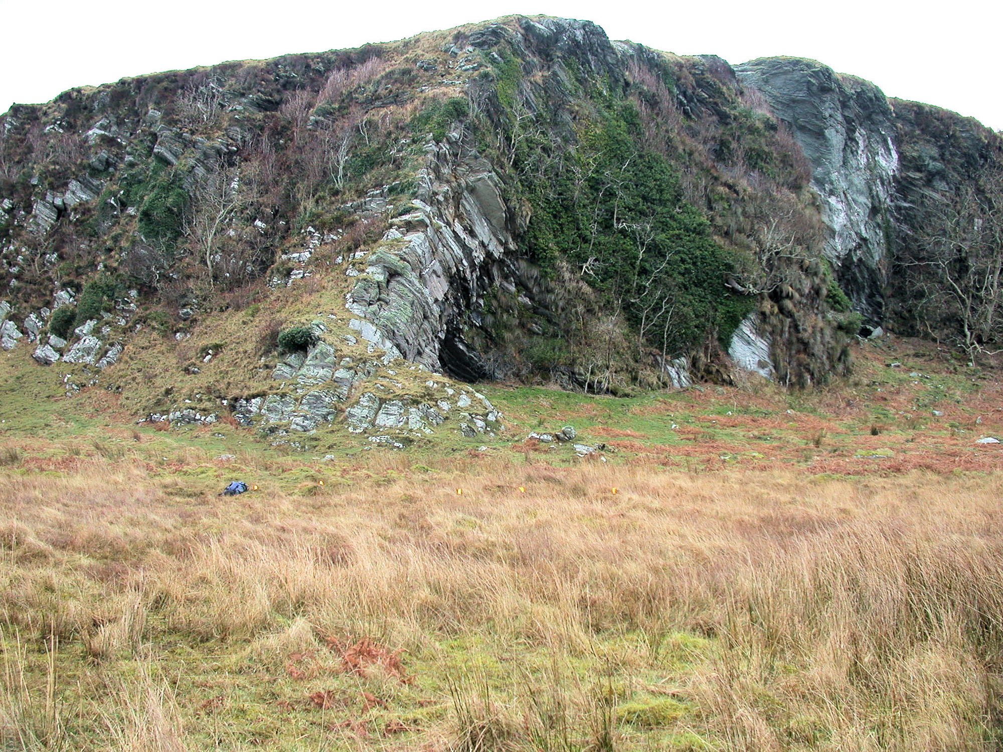
Argyll has all the typical scenery of a recently glaciated landscape. Some of the largest features are the impressively deep glacial troughs now filled with water, sea water in the case of Loch Leven, Loch Etive, Loch Fyne and Loch Long but freshwater in the case of Loch Awe. The ice-scoured glens and straths have steep, craggy sides and flat valley bottoms that are covered in glacial till and extensive fluvio-glacial deposits washed down by meltwater as the glaciers decayed. The last glacial advance some 10,000 years ago has left a legacy of sharp peaks and ridges and deep coires, typical of the higher mountains. One further effect of the retreat of the glaciers has been the rebound of the land as the weight of ice was removed, leading to extensive raised beaches and their associated cliff lines, a very important habitat for our oceanic bryophytes.
Although all of the higher mountains are concentrated in the north and east of the county, all of the land is hilly and there is much exposed rock everywhere. The only significant areas of lower ground are in the south and west of the county but even here the terrain is often still rough. The largest body of freshwater is Loch Awe, which, at 37km, is the longest loch in Britain, but lesser lochs are frequent everywhere except in Cowal. With numerous islands and long narrow sea lochs VC98 has a coastline of prodigious length, in excess of 700km. Much of this is sheltered by the islands and so the large sand-dune systems of the exposed outer islands are absent but this means that there is a lot of good habitat for bryophytes on coastal crags not exposed to the extreme westerly gales.

Calcareous schist crags on Beinn Laiogh with a rich bryophyte flora.

Rhyolite crags on the north side of Bidean nam Bian in Glencoe.

A fine wooded ravine based on a basalt dyke which is visible on the left.
Over much of Argyll, metamorphic rocks of the Dalradian series provide the substrate for the bryophytes and these vary from the metamorphosed limestones of Appin, Lismore and Meall Mor in Glencoe and the calcareous schists that outcrop on Beinn an Dothaidh and Beinn Laoigh, to the rather less productive schistose grits of the south, in Cowal and the Arrochar hills. The area from Glencoe, through Glen Etive to Rannoch Moor has a complex of large granite intrusions and, in Glencoe, associated volcanic rocks, the granite being rather dour but some of the volcanic rocks in Glencoe are base-rich. Older volcanic activity has laid down the basalts and andesite of the Lorne Plateau inland from Oban and this reaches the coast around Kilmelford and on Kerrara. The whole area has large numbers of basalt intrusions associated with Tertiary volcanic activity and these can have an effect on the base-status of the country rock and they have an added importance as the more easily eroded basalt is often the base for many of the spectacular ravines. The oceanic climate means that much of the ground is covered by ombrotrophic mire, even on quite steep ground; this is most extensive on Rannoch Moor but there are large areas of mire in most areas, though some were subjected to misguided plantations in the past.
In view of the above description, it is no surprise that the bulk of the land is of low agricultural value and is used either for extensive grazing or for forestry and, on the larger estates in the east, for stalking. If you have an interest in arable bryophytes, Argyll is not the place for you, even the traditional arable crop of barley is now bought in, although more favoured areas do have tracts of improved pasture. Grazing pressure, in the past from high stocking densities of sheep and today from the increasing deer population, mean that the best place to look for interesting bryophytes on the lower ground is on the crags or in ravines where the grazing pressure is less and so the tree cover greater.

Many ravines are hemmed in by sitka but still have a good bryophyte flora; this ravine has Acrobolbus wilsonii amongst other nice things.
The low agricultural value of the land has always made Argyll an attractive proposition for the forestry industry and since the First World War and increasingly in the 1970s, when the tax regime was so beneficial, large areas of land were planted up with non-native conifers, particularly in the south and west. This meant that many interesting bryophyte habitats were lost, mire and flushes drained by deep ploughing, ravines shaded out by trees planted too close and even ring-barking of oak trees. We are now at a time when the 1970s timber crop is being clear-felled and sites are being re-stocked but now in a more enlightened manner, keeping a distance from burns and not planting on deep peat and having a percentage of the re-stock area as broadleaf woodland; many forest managers now know what a bryophyte is. Even so, with the recent government policy to plant many more trees it is likely that more open habitat that is good for bryophytes will be lost unless we are very vigilant.
The climate

Glencoe always seems to be the epicentre of Argyll’s damp climate.
Argyll has a very oceanic climate which essentially means cool, wet winters and, yes, cool wet summers. The prevailing winds come from the west, from the sea, laden with moisture and so the clouds are blown onto the steep-sided mountains, a confrontation that produces prodigious rainfall figures. So the whole of the county is wet but there a lot of variation even over quite short distances; the weather station at Benmore Botanic Garden has a 10 year moving average rainfall in excess of 2500mm while Tighnabruaich just a few kilometres to the west has just (!) 1700mm. At the heads of the sea lochs and up in the bigger hills the annual rainfall will exceed 3000mm, and, presumably as a result of climate change, the ten-year moving average is slowly rising. For the oceanic bryophytes and the remnants of the temperate rain forest in which many of them grow, it is not the total rainfall figure that is important, it is the number of wet days (more than 1mm of rain) that is critical and a lot of Argyll has more than 220 wet days per year – so forget the sun-cream. The proximity of the warm sea to the west means that, at sea level, frosts are uncommon and persistent snow cover is rare, again conditions that favour our oceanic bryophytes. At the other extreme some of the mountains, like Bidean nam Bian and Beinn Laoigh, are high enough to retain patchy snow cover in sheltered coires well into the summer.
People
Main Argyll has a small population of around 45,000 in scattered villages and clachans mostly dispersed around the coast and with only two modest towns in Oban and Dunoon and smaller centres at Inverary, Lochgilphead and Ballachulish. The administrative county has the fourth lowest population density in Scotland at 0.17 people per hectare and this means that inland there are large areas with no public roads, particularly in the Blackmount, and this has an obvious effect on botanical exploration, some places need determination and maybe a tent, to allow time for exploration.
There is a long history of bryophyte recording in Argyll from Hooker’s visits in the early 1800s and visits by luminaries like Binstead, Knight, Dixon, Macvicar and JB Duncan in the late 19th and early 20th centuries. These visits tended to concentrate on the mountains both in Glencoe and on the calcareous schist on Beinn Dorain and Beinn Laoigh when most of the interesting bryophytes were found. Gradually the net was spread wider and the oceanic woodlands and ravines were explored and the good flora on the Appin limestone discovered. The BBS has visited the vice-county on four occasions (1953, 1972, 1981 [part] and 1996) and the reports of these meetings are on the BBS website. For some years in the 1960s and 1970s there was more systematic recording in the west of the county by Martin Corley and the current Recorder moved up to Cowal, in the south of the county, in 1981. Special mention needs to be made of a survey of many of the Argyll woodlands by Ben Averis, mostly in the late 1980s but with subsequent visits in later years, producing many thousands of new records. But the popular areas have always been popular(!) so the productive areas in Glencoe and the calcareous schist of Beinn an Dothaidh, Beinn Dorain and Beinn Laoigh and, to a lesser extent, some of the oceanic woodland sites in the west have seen numerous visits from bryologists from the south. So, VC98 is well-recorded but there is no general account of the bryophyte flora. There are still some large blank areas with many tetrads having no records at all, so I would encourage you to not always go back to the honeypots! And, of course, send me the records.
The bryophytes

Typical oceanic Lejeunea community here with Radula aquilegia, Harpalejeunea molleri, Aphanolejeunea microscopica, Lejeunea patens and Colura calyptrifolia.

Targiona hypophylla on the raised beach cliff line on the island of Kerrera
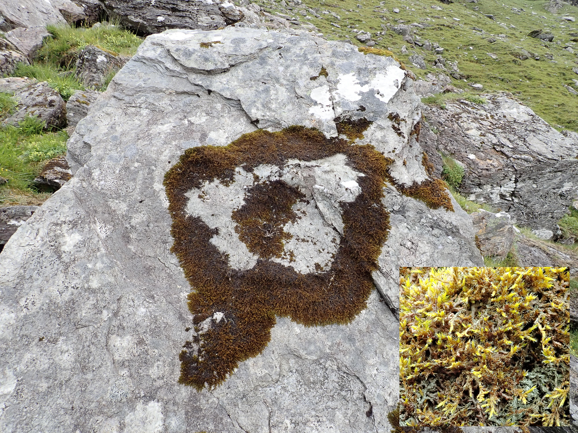
Such variety of habitat means that we have a prodigious bryophyte flora, over 75% of the UK’s mosses and liverworts occur in Main Argyll. Pride of place in global terms goes to the oceanic flora, both in the woodlands and up on the hills. Anywhere that there are patches of rocky broadleaf woodland with a reasonably complete canopy and particularly where there is a burn in a ravine you will find good populations of oceanic bryophytes. The oceanic Plagiochila species are common and the “Lejeunea community” is often well developed with species like Cololejeunea microscopica (Aphanolejeunea microscopic)a, Harpalejeunea molleri, Drepanolejeunea hamatifolia, Colura calyptrifolia and Radula aquilegia having many sites. The limestone areas of the west, centred on Lismore and Appin have some of the same species where there is woodland but also have the only Scottish populations of Plasteurhynchium striatulum and Pedinophyllum interruptum as well as very locally frequent Targionia hypophylla.

Scapania nimbosa is quite frequent in heathy scree on Bidean nam Bian in Glencoe.
Racomitrium himalayanum is locally abundant on the south side of Beinn Dorain.
Up in the hills, particularly in the north of the county, there are good populations of the big oceanic hepatics like Plagichila carringtonii, Anastrophyllum donnianum, Scapania ornithopoides, Scapania nimbosa and Bazzania pearsonii. The calcareous schist hills in the east of the county have many of the species of the Ben Lawers area with good populations of montane calcicoles like Orthothecium rupestre, Myurella julacea, Amphidium lapponicum, Mnium thomsonii, Encalypta alpina, Plagiopus oederianus, Scapania degenii, Scapania cuspiduligera and Mesoptychia heterocolpos (Leiocolea heterocolpos) and rarities like the Scottish endemic Bryoerythrophyllum caledonicum, Racomitrium himalayanum and Timmia norvegica. The volcanic rocks on the north side of Bidean nam Bian are also calcareous, and are a well-known site for Saxifraga cernua but also have some good bryophytes, more Bryoerythrophyllum caledonicum, plus Brachythecium cirrosum, Lescuraea patens and snowbed species like Andreaea nivalis and Cephalozia albescens. Also in Glencoe, the limestone on Meall Mor has flushed grassland with Solenostoma confertissimum, Mesoptychia gillmanii, Saccobasis polita and Barbilophozia quadriloba and Hypnum bambergeri on rocks high up.
Sites to visit

Rhytidium rugosum on the Lorne Plateau andesite
Almost any area of broadleaf woodland on a rocky slope and particularly those with a burn are worth exploring. Well known sites with easy access and a good range of oceanic species are Glen Nant NNR near Taynuilt (NN019272), Glasdrum NNR in Glen Creran (NN001454) and the lost Valley in Glencoe (NN172561).
The limestone and the Lorne Plateau andesite. The island of Lismore is all limestone (NM8643) and a delightful place and the limestone outcrops again in Appin (NM9347), all reasonably accessible. Meall Mor in Glencoe (NN1156) is also limestone and sits above the main road so access is easy but the ground is quite steep. The coast at Loch Melfort is a fine place for a walk (NM7712) and has andesite crags with Rhytidium rugosum and Grimmia tergestina.
The some of calcareous schist hills in the north-east of the county are reasonably accessible but are genuine mountain walks. The VC98 part of Beinn Laoigh is best approached from forestry car park in Glen Lochay (NN238278) but be warned if it has been raining you will get wet feet crossing the river. The other two rich hills, Beinn Dorain and Beinn an Dothaidh are best approached from Bridge of Orchy (NN300394) and from Achallader (NN322442 but parking now at the main road) respectively and involve modest mountain walks.
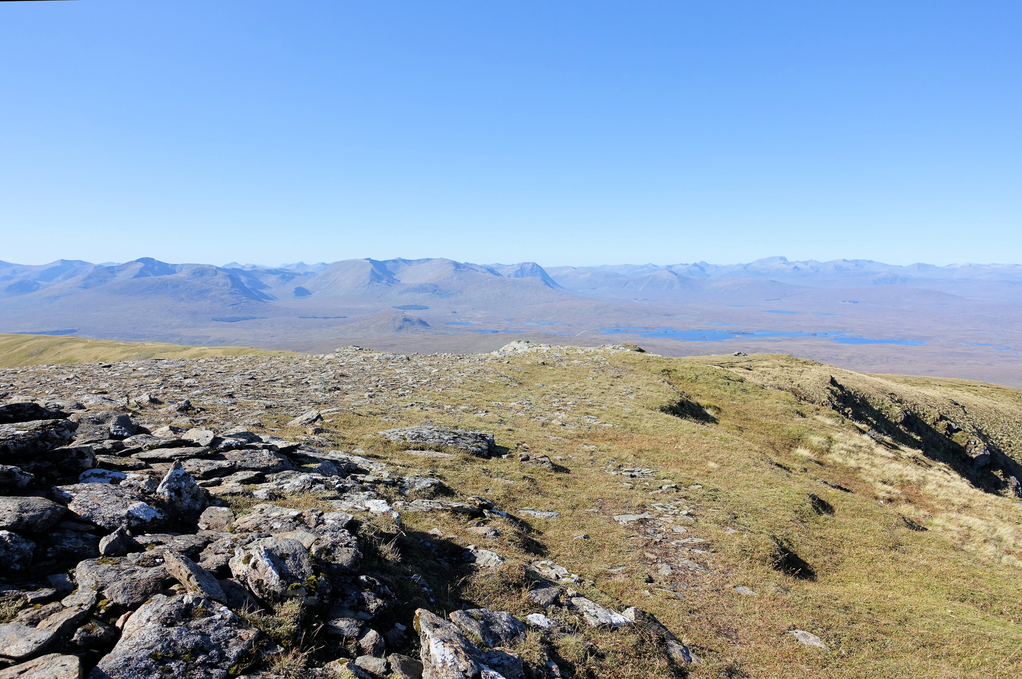
Looking across Rannoch Moor to the granite hills of the Blackmount with the Glencoe hills beyond and Ben Nevis on the far right
The granite hills of Glen Etive and the Blackmount are less productive and access is less easy except at the ski resort on Meall a’Bhuiridh (NN266525) where you can take a chairlift! However, these hills are woefully under-explored botanically and might tempt those who like to get off the beaten track. Rannoch Moor (NN3149) is also on the granite and is very accessible from the A82 and has interesting Sphagna.